Vermont · Swimming Holes
Lareau Swim Hole
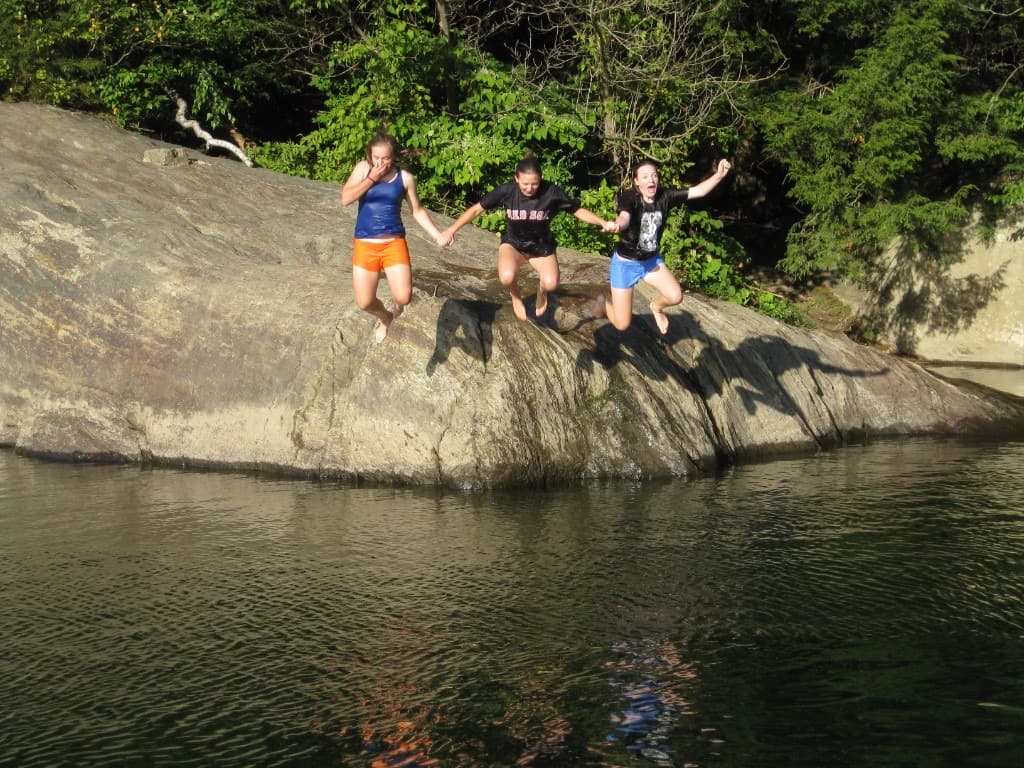
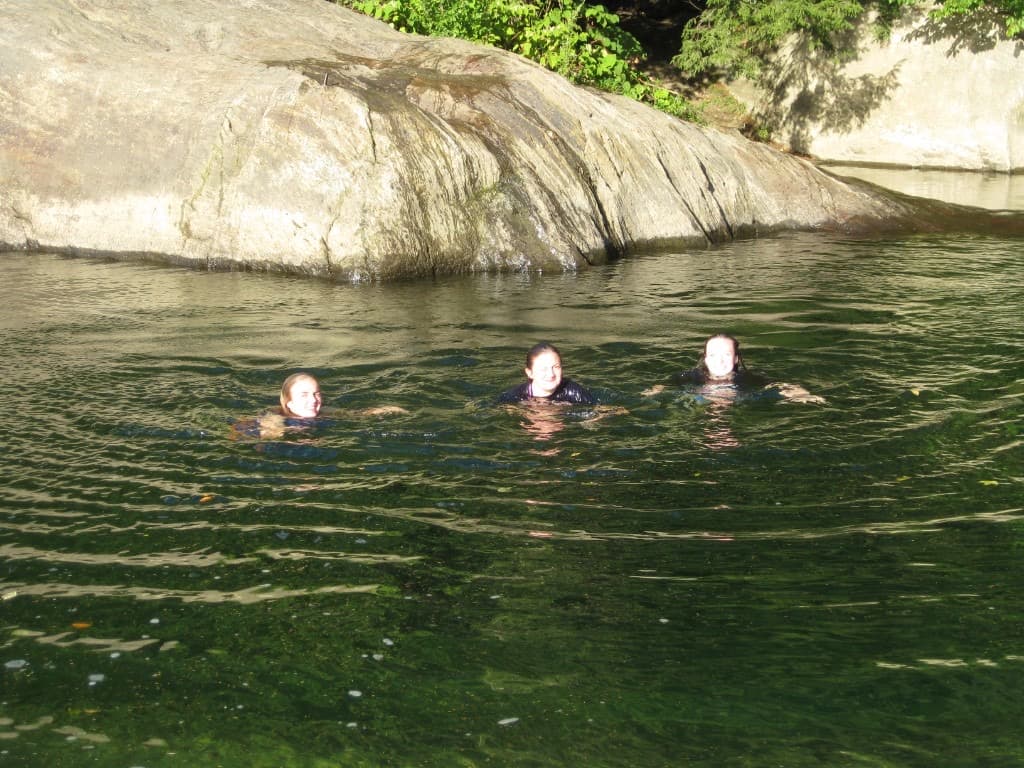
Easy Mad River stop off Vermont Route 100 near Waitsfield: short walk from the pin, cold water, and busy fair-weather weekends. Families wade in some spots while others use ledges for jumping; tubes and floats show up when the river looks gentle. After rain, expect stronger current, more color, and slick rock.
Short roadside approach on the Mad River—plan for cold water, mixed use (waders, floaters, jumpers), and summer crowds.
Waitsfield · Mad River Valley
First Time Here
Access is straightforward by swimming-hole standards: the pin is the main parking / entry area, then a short walk to the river. Footing is still uneven and wet rock stays slick even when the air feels hot—shoes with grip help.
Expect mixed use in the same corridor. Families often wade and play in shallower water while other visitors use ledges for jumping—stay aware upstream, give jumpers space, and decide what matches your group before you settle in.
Tubes and inflatable floats appear when the river looks slow and clear enough; in higher or faster water, floating with the current is a different risk profile than wading—match your gear to what you see, not to a busy weekend memory.
Summer weekends mean more cars, people, and noise along Route 100. Weekday mornings and off-peak hours are usually calmer. After storms, the Mad River often runs harder; if it looks bigger or louder than you expected, wait or pick another day.
Should You Go
Good for
- River swimmers and waders who are comfortable with cold Vermont water
- Visitors fine adapting to Route 100 context and heavier summer use
- People who move carefully on slick stone and avoid treating any gage as a depth meter
Skip if
- You need lifeguards, ropes, or a managed pool
- You want a quiet, little-known spot—fair-weather weekends can feel crowded with parking pressure
- High or fast water after rain makes you uneasy—current here can strengthen quickly
Safety on site
This is informal river use, not a lifeguarded beach. Cold water is normal year-round. Do not treat a calm surface as proof of shallow or slow water underneath. Skip the swim if the river is high, fast, or murky after recent rain, or if you hear flood-related messaging—wait until you can read comfortable, obvious conditions at the bank. On site, watch for slick ledges and cobble, uneven drops, and current that can strengthen quickly; keep children within reach in moving water. Crowds add another hazard—float lines, jump zones, and wading areas can overlap, so communicate and give others room. Park only where posting allows; Route 100 is a working highway. Verify signs, neighbor boundaries, and access the day you visit. This guide is independent and not a land-manager or legal source.
Map & Trail
Vermont Route 100 through Waitsfield. Maintainer intake frames the primary entry across from the Lareau Farm area; coordinates mark the main parking / entry point. Match signage and safe roadside use on the day you go.
- Short approach from typical parking to the river; footing and bank crowding vary with season and weather.
- After heavy rain, expect more color and force in the Mad River—read what you see, not only a screen.
Gallery